Lonevi
Lonevi: the Science section gets its own home page and a map of research
The Lonevi Science section now opens with the latest piece, keeps its reference catalogs alongside, and adds a map of where clinical trial sites are and where the catalog's drugs are registered.
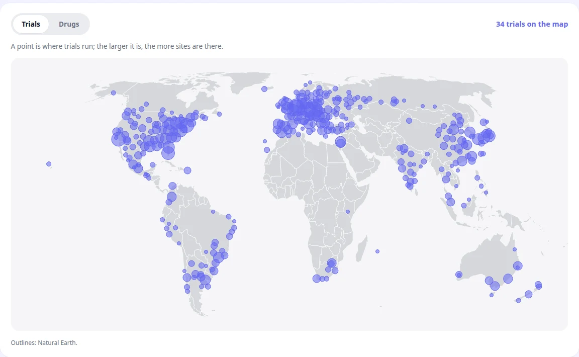
On 2 October 2026 Lonevi shipped an update to its Science section. The section now has its own home page and a map that shows where in the world clinical trial sites are and where the drugs in its catalog are registered. The section is open without signing in: lonevi.com/science.
What changed for readers
The section's home page opens with the latest piece: its cover sits next to the headline, followed by three more recent pieces and a link to the full list of pieces.
The reference catalogs — publications, clinical trials, drugs and diseases — live on the same page. Every card points to a world code: PMID or DOI, NCT number, INN and ATC code, ICD.
Pieces are published in two languages again, English and Russian, with a language switch on the article page.
The “Where the science happens” map
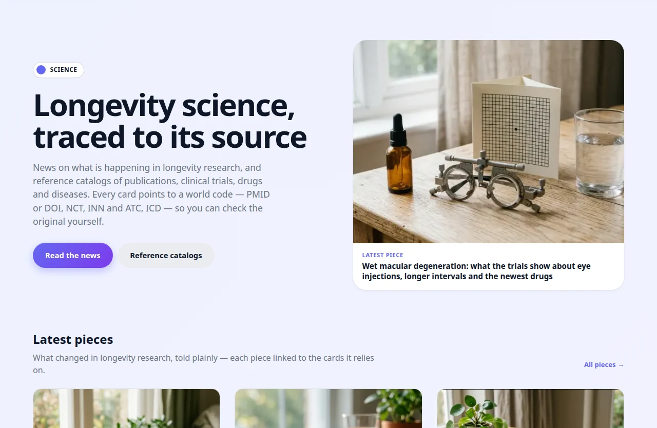
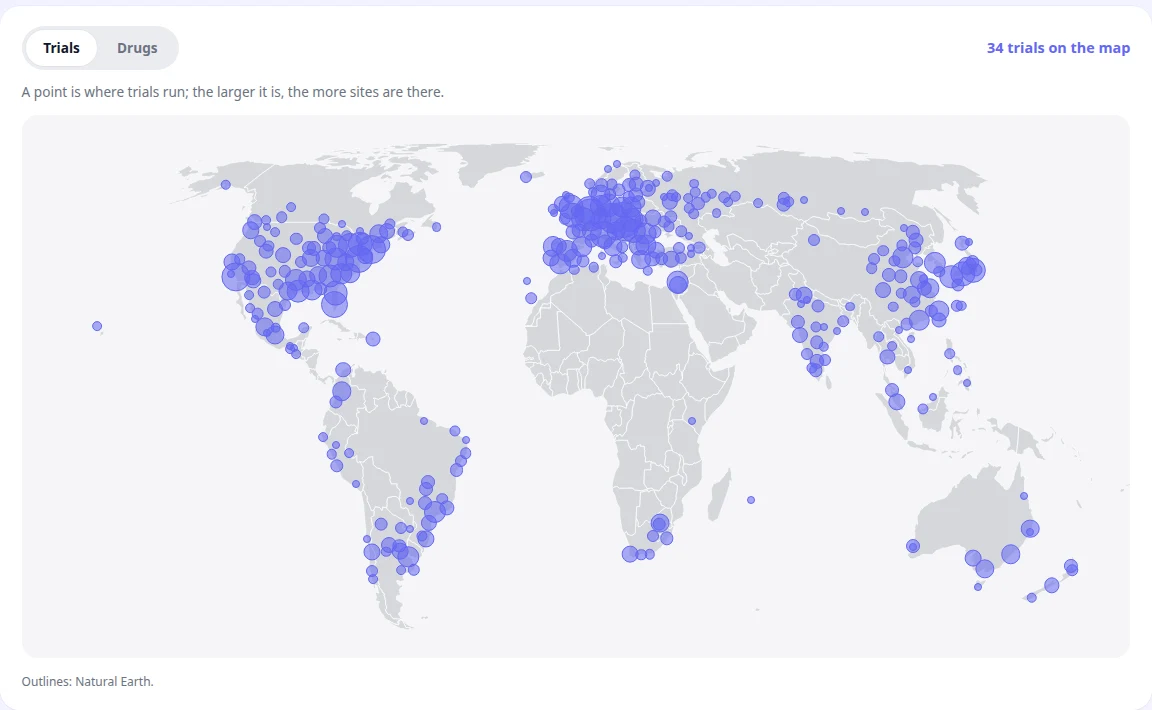
The map has two layers. The Trials layer shows clinical trial sites from the ClinicalTrials.gov registry: nearby sites merge into one point, and the larger the point, the more sites it holds. The Drugs layer places a point on each country where a regulator has registered the drug; countries with no outline on the 1:110m map are listed in a line rather than dropped. Selecting a point opens its card, or a list when several cards share the point.
How we built it
We built the map without an external mapping service: no loaded tiles and no third-party platform keys. Country outlines come from the open Natural Earth dataset, and the Lonevi server computes the point coordinates and sends them to the browser ready to draw. Like other parts of the Lonevi interface, the new block appeared in the product's design system first and only then on the page.